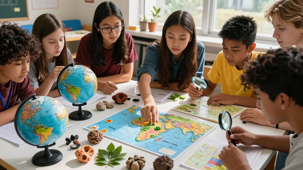
You make geography lessons multi‑sensory by letting learners feel raised‑line maps, hear rhythmic audio cues for rivers or mountains, and smell or taste region‑specific scents and foods. You pair tactile textures with scented cotton for forests, smooth beads for water, and clay for landforms. You layer real‑world soundscapes—traffic, market chatter, birds—over the map, and use verbal prompts, pauses, and rhythmic narration to reinforce memory. Keep the activities low‑cost, collaborative, and inclusive, and you’ll discover even deeper strategies.
Design Hearing‑Sensory Maps for Multisensory Geography

A handful of simple steps can turn any tactile map into a hearing‑sensory tool that guides you through geography with sound.
First, pair each raised line or symbol with a brief audio cue that uses rhythm and tone to highlight rivers, mountains, or settlements.
Pair each raised line or symbol with a brief rhythmic audio cue to highlight rivers, mountains, or settlements.
Next, embed guided listening segments that layer real‑world sounds—traffic, market chatter, birds—so you associate auditory context with specific locations.
Use verbal labels, echoing questions, and timed pauses while you explore, boosting memory encoding and accessibility.
Combine raised‑line maps, tactile symbols, and spoken navigation for seamless tactile‑audio integration, reinforcing spatial relationships through touch and sound simultaneously.
Finally, scaffold activities that gradually blend listening, speaking, and hands‑on mapping, deepening your metacognitive awareness of how hearing enhances multisensory geography.
In fact, incorporating sensory texture matching activities, similar to those used in Montessori learning tools, can further enrich tactile exploration and cognitive engagement.
Low‑Cost Tactile Models for Multisensory Geography
What if you could turn everyday objects into tactile geography tools without spending a dime? You can repurpose cardboard, yarn, sand, and locally sourced clay to craft low‑cost models that let students feel mountains, rivers, and borders. These multisensory, tactile aids require little technology, so classrooms with limited budgets still explore spatial concepts. By shaping textures that mimic terrain, you boost accessibility for visually‑impaired learners and bridge the digital divide. Students manipulate the pieces, building ownership while developing metacognition and spatial reasoning across cognitive and psychomotor domains. Community problem‑solving emerges as they refine models together, turning simple resources into powerful geography experiences that are inclusive, engaging, and affordable. Incorporating tools like magnifiers with glass lenses can enhance detail observation and tactile exploration during geography lessons.
Soundscapes for Multisensory Geography Lessons

Ever wondered how a simple sound can make a continent feel tangible? You can turn geography education into a living experience by layering soundscapes over maps. Ambient market chatter, river flow, or wind through trees become auditory anchors that pair place names with specific sonic cues, boosting recall.
When you weave regional music, dialects, or street sounds into lessons, you create auditory storytelling that deepens cultural flexibility and empathy. Guided listening walks let students analyze authentic recordings alongside visuals, revealing spatial patterns they might miss on paper. By adjusting voice tone, rhythm, and pauses, you enrich multisensory learning and give every learner a richer, more immersive sense of place. Incorporating tools with multi-sensory safety features can further enhance engagement by ensuring a tactile and secure learning environment.
Inclusive Multisensory Geography for Visually‑Impaired Learners
You’ll start by choosing tactile map materials that let you feel coastlines, borders, and terrain. Then you’ll layer auditory spatial cues—varying tones, rhythms, and pauses—to convey distance and direction. Finally, you’ll engage peers in collaborative exploration, so everyone contributes to a shared, inclusive geographic experience.
Tactile Map Materials
How can you turn everyday items into tactile maps that let visually‑impaired learners explore continents, rivers, and mountains without a screen? You can repurpose cardboard, foam sheets, sandpaper, and yarn to craft tactile maps that boost spatial awareness and accessibility. Pair textured surfaces with raised lines for borders, scented cotton for forests, and smooth beads for water bodies. This hands‑on approach fuels multisensory learning, letting students feel elevation changes and distance relationships while you guide observation and interaction.
| Material | Sensory Feature |
|---|---|
| Cardboard | Firm base, easy to cut |
| Foam sheets | Soft hills, mountains |
| Sandpaper | Rough terrain, deserts |
| Yarn | Flowing rivers, borders |
| Scented cotton | Forests, flowers |
These low‑cost tools let you create inclusive geography lessons that scale across classrooms. Incorporating interactive elements like those found in Montessori play kitchens can further engage learners by stimulating multiple senses during activities.
Auditory Spatial Cues
Where can you hear a continent’s shape without seeing it? You use auditory cues to paint borders, rivers, and mountains in the mind. By describing changes in tone, rhythm, and pauses, you reveal spatial relationships that map features alone can’t convey. Structured tasks—narrated routes, descriptive sensing of surroundings—let visually‑impaired learners build mental maps through listening. You time each phrase carefully, using phonetic markers to signal distance, direction, and elevation. This approach creates multi‑sensory learning where sound anchors geography concepts. As a teacher, you model these strategies, adjusting pacing and emphasis to ensure equity. The result is an inclusive classroom where every learner navigates the world through sound‑driven spatial awareness. Incorporating manipulative components like beads and cards from wooden educational tools can further enhance tactile and auditory learning integration.
Collaborative Exploration Strategies
Ever wondered how a group can turn a simple classroom into a living map for visually‑impaired learners? You’ll notice that collaborative exploration hinges on vivid verbal description, purposeful tone, rhythm, and pauses that map space while peers handle tactile geography aids. Low‑cost, locally sourced models let you feel hills, rivers, and borders, turning abstract data into a multisensory experience. By assigning community observer roles and building neighborhood maps together, you foster inclusive education and peer learning. Teacher‑learner reflection refines activities, ensuring each student’s sensory profile guides the process. Assessment shifts to experiential outcomes, blending verbal, tactile, and collaborative outputs that align with Bloom’s taxonomy. Incorporating hand-woven baskets as tactile aids can enhance spatial understanding through textured, natural materials in geography lessons.
| Role | Activity | Sensory Focus |
|---|---|---|
| Observer | Describe terrain | Auditory |
| Builder | Assemble tactile map | Touch |
| Analyst | Compare notes | Visual‑verbal |
| Facilitator | Guide pauses | Rhythm |
| Reflector | Review outcomes | Multisensory |
Field Walks in Multisensory Geography
You’ll design sensory exploration routes that let students feel, hear, and smell the environment while you guide them with tactile map creation. By weaving community narratives into each walk, you connect classroom concepts to real‑world stories. These activities empower diverse learners to build geo‑literacy through hands‑on, inclusive experiences. Integrating Montessori-inspired learning tools can further enhance sensory engagement and cognitive connections during field walks.
Sensory Exploration Routes
A sensory exploration route turns a simple field walk into a living laboratory, where you hear traffic hum, smell blooming flowers, feel pavement textures, and capture visual details with a camera. You’ll notice how multisensory field walks deepen geo‑literacy as you compare urban buzz with park quiet, recording sounds on a recorder and scents in a notebook. By guiding students through varied neighborhoods, you foster inclusive, multilingual observations and spark descriptive vocabulary.
| Sense | Tool | Example |
|---|---|---|
| Sight | Camera | Photograph storefronts |
| Sound | Audio recorder | Capture bird calls |
| Smell | Notebook | Note rosemary aroma |
These sensory exploration routes make geography tangible, encouraging reflection and cultural awareness while reinforcing core concepts.
Tactile Map Creation
How can you turn a simple neighborhood stroll into a tactile learning tool that everyone can explore? You start by gathering low‑cost, locally sourced materials—cardboard, fabric, foam—to sketch the street layout you just walked. While you walk, you record texture, sound, and scent cues, noting curb ramps, shop fronts, and park benches. Back in class, you translate those observations into tactile maps, embedding raised lines for pathways and textured symbols for landmarks. This hands‑on process fuels multisensory learning, letting visually impaired peers feel the same spatial story. By involving all learners in design and testing, you create inclusive education experiences that deepen problem‑solving and boost geo‑literacy. The final maps become shared, sensory‑rich representations of your community.
Community Narrative Integration
Ever wondered how a simple stroll can become a shared story? You lead learners on multisensory field trips where they listen to street vendors, sniff fresh bakery aromas, and capture textures with phones. By weaving community storytelling into place‑based learning, you turn observations into a collective narrative that reflects local history, language, and accessibility concerns. Families join via Skype, adding home perspectives that deepen sensory geography and reinforce geo‑literacy. Project‑based investigations let students interview local experts, map multilingual signs, and create topic webs that highlight equity and diverse abilities. The result is a living map of memory, where every scent, sound, and sight builds a stronger, inclusive sense of place.
- The smell of fresh‑baked bread triggers vivid memory.
- A child’s laughter echoes through a park, linking joy to geography.
- A resident’s story about a corner store anchors history in the present.
Smell, Taste, and Touch to Teach Geographic Features
Ever wondered why a whiff of pine or the taste of a tangy mango can instantly transport you to a specific region? You can harness that power by pairing smell, taste, and tactile cues with geography lessons. When you sprinkle the scent of eucalyptus while mapping Australian bushland, students link aroma to climate and vegetation. A bite of spicy kimchi while studying Korean peninsulas ties foodways to regional resources. Modeling cliffs with textured clay lets learners feel elevation changes, reinforcing spatial concepts. These multi‑sensory tactics turn abstract maps into concrete experiences, boosting recall and engagement.
| Sense | Classroom Application |
|---|---|
| Smell | Diffuse local flora scents during map work |
| Taste | Sample region‑specific foods (safe, small bites) |
| Tactile | Use clay or textured maps to shape landforms |
How to Check If Your Multisensory Geography Lessons Are Working?
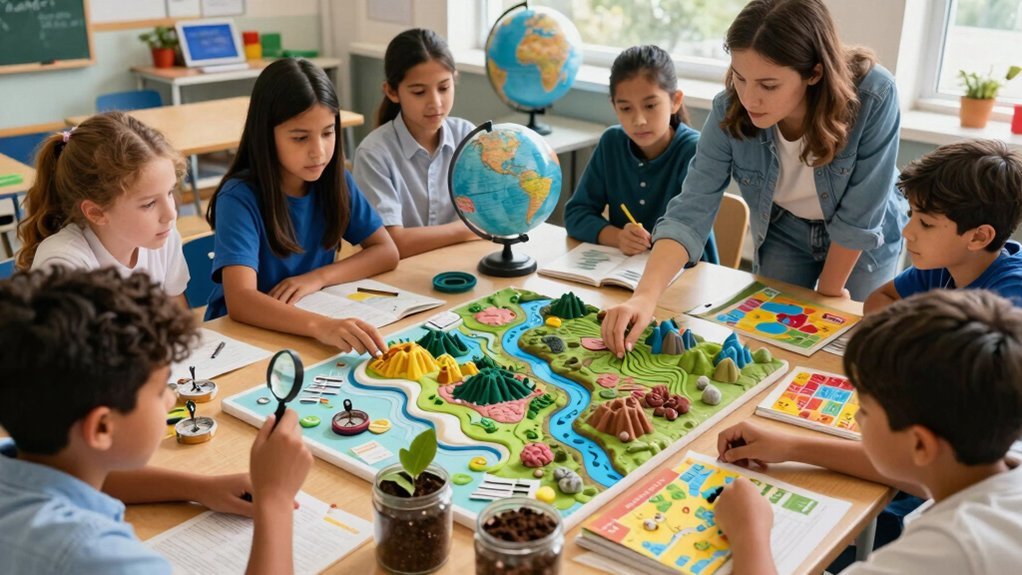
Wondering whether your multi‑sensory geography lessons are truly effective? Start by setting clear geo‑literacy goals and then run a quick assessment after each session. Watch for sharper retention, richer place descriptions, and deeper explanations in student work. Capture qualitative feedback from kids and caregivers about engagement and accessibility. Document which senses you used—visual maps, auditory songs, tactile manipulatives, or kinesthetic movement—and note which combos spark the most insight. Use this data to fine‑tune future lessons and prove that your multisensory approach boosts learning.
- You see students humming location names, their eyes lighting up with new maps.
- Parents report kids eagerly discussing continents at dinner.
- You feel confidence as assessment scores climb, confirming genuine geo‑literacy growth.
Frequently Asked Questions
What Does Multi-Sensory Teaching Mean?
You engage multiple senses—seeing maps, hearing explanations, touching models, maybe even smelling related scents—so you process information through visual, auditory, kinesthetic, and sometimes tactile cues, boosting retention.
Why Is Geography a Multidisciplinary Science?
You see geography blend physical landscapes, human cultures, economics, politics, and history, so you analyze places from multiple angles, linking environment, society, and resources to understand how they interact and evolve.
What Is the Reason Orton Gillingham Is Considered a Multisensory Approach to Teaching?
You consider Orton‑Gillingham multisensory because it simultaneously engages your hearing, sight, and touch—having you say sounds, see letters, and trace them—so you process language through multiple channels at once.
How to Make a Lesson Multisensory?
Start by blending visuals, sounds, and movement: show maps, play related audio, let learners build models, use interactive apps, and incorporate storytelling or role‑play, so every sense engages the lesson.